Scientific presentation
Scientific Program

More than 100 researchers of 43 worldwide research institutions are involved in the Polar POD scientific program.
All data will be available to the entire scientific community as well as the general public, making the Polar POD an exceptional educational tool.
It will be an essential contribution to the program of the United Nations Decade of Ocean Science for Sustainable Development (2021-2030).
Our scientific program on board Polar POD and PERSEVERANCE
-
Our research fields
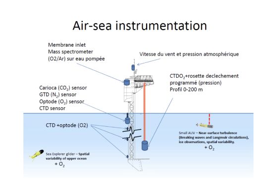
Atmosphere-ocean exchanges
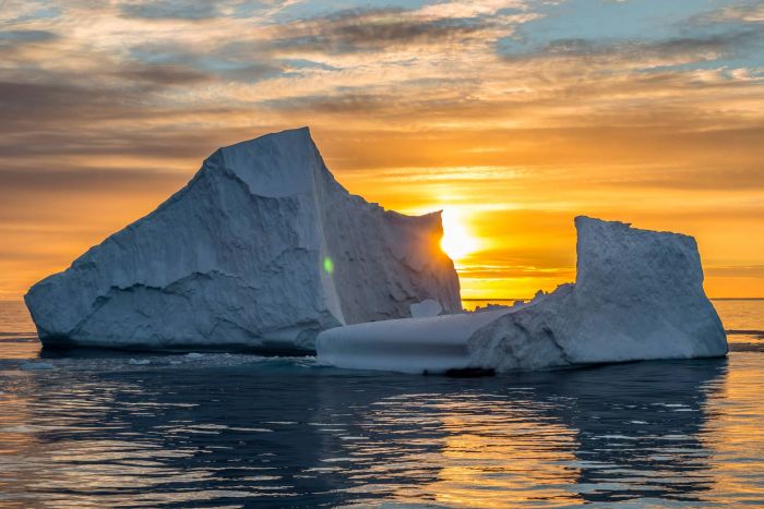
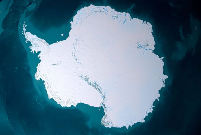
The Southern Ocean (SO) is a highly turbulent system and a key component of the climate system.
Although it covers only about 30% of the ocean surface, models indicate that it is responsible for about 50% of anthropogenic CO2 absorption (human).
Polar POD's ability to remain stable in rough seas will reduce the impacts that affect air-sea exchange measurements taken from large research vessels.
Remote sensing of the Southern Ocean by satellite
This involves calibrating satellite measurements based on field observations: weather conditions, sea conditions, wind and waves, and ocean color.
In particular, phytoplankton reflects the resources available to the marine ecosystem and the ocean's capacity to absorb CO2 through photosynthesis, known as the “biological pump.” .
Zooplankton, which feeds on these microalgae, emits fecal pellets that sink to the bottom of the ocean where they sediment. This is how carbon has been sequestered at the bottom of the oceans for hundreds of millions of years.Marine wildlife inventory
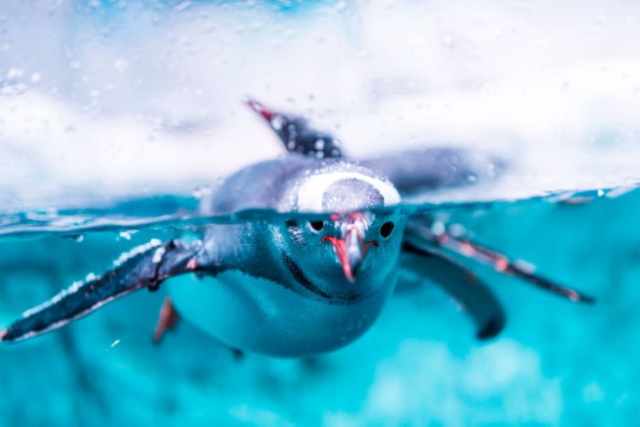
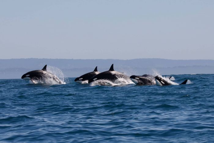
Polar POD is a zero-emission vessel. This silent platform will be equipped with highly sensitive hydrophones to capture the underwater soundscape.
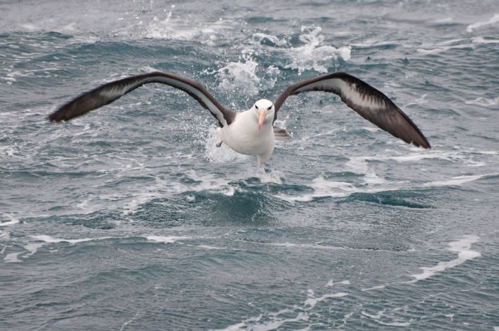
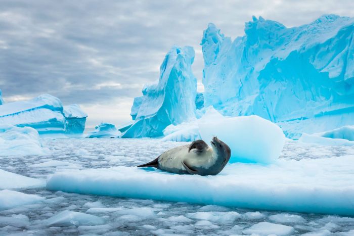
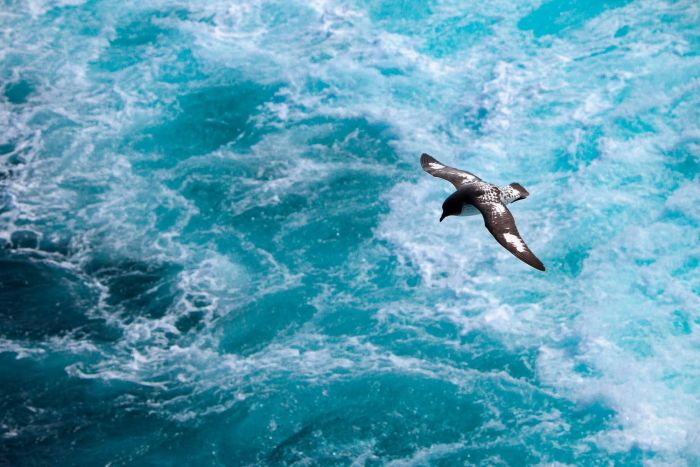
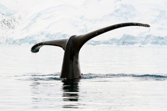
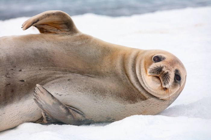
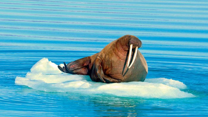
We know the acoustic signature of all species, from krill to mammals, and continuous listening will enable us to compile an inventory of marine fauna across all four seasons for three consecutive years.Analysis of microorganisms, observations of seabirds and even giant squid are on the agenda.
Anthropogenic impacts
Although the Southern Ocean is the most remote ocean on Earth, a wide range of anthropogenic pollutants has been detected in this region at various levels: krill, plankton, fish, seabirds, and marine mammals.
The Southern Ocean is almost the last unknown territory for contaminants. The focus of our investigations will be microplastics, pesticides, persistent organic pollutants, heavy metals, and more.
-
Supported programs
Oceanography
The National Surface Salinity Observation Service (SNO SSS), coordinated by LEGOS (OMP, Toulouse) with the support of IRD, relies on the sailing ship's campaigns to monitor ocean salinity, a key climate parameter. In partnership with Oceano Vox and Ifremer, data is also collected on ocean currents and their evolution. In addition, as part of the PlanktoSpace program (ESA – NASA – CNRS – University of Maine), optical measurements taken at sea are used to calibrate satellite observations.
Biodiversity
The participatory Plankton Planet program (CNRS – Sorbonne University) uses the sailing ship to collect data on the richness and evolution of the ocean microbiome, involving scientists and citizens. The sailing ship has also been used for bioacoustic missions conducted by the CNRS and the University of Toulon to listen to and census marine mammals in Svalbard.
Pollutants
Under the responsibility of the Institut de Physique du Globe de Paris (IPGP), the ship measures concentrations of atmospheric pollutants such as mercury, ozone, and nitrogen oxides. In the ocean, a device developed by Ifremer and IRD detects the presence of dissolved mercury and micropollutants, even in polar regions.
Atmospheric measurements
A photometer developed by the CNRS and the University of Lille, integrated into the international AERONET network coordinated by NASA, tracks aerosols. These measurements are complemented by innovative projects: CosmicSail (Astrolabe Expedition) detects cosmic particles, while the CNRS and the University of Toulon are conducting bioacoustic campaigns to listen to and census marine mammals.
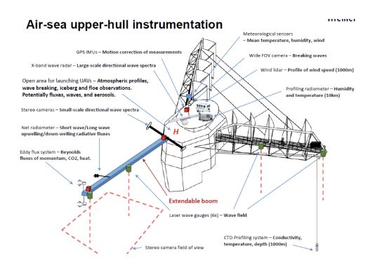
Permanent instruments
Atmospheric measurements
The ship has a Mercury weather station (Météo France) that continuously measures:
air and sea temperature;
atmospheric pressure;
relative humidity;
wind speed and direction;
cloud cover and other standard variables.
This data is transmitted to meteorological centers in near real time (VOS - Voluntary Observing Ship) to enrich analyses and forecasts, and to calibrate satellites. It is also used to interpret oceanographic and atmospheric measurements in context.Oceanographic measurements
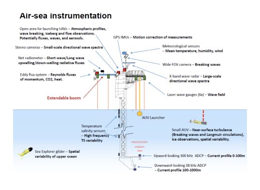
Using an acoustic Doppler current profiler (ADCP), it is possible to capture the speed and direction of water masses in the water column, revealing the underlying circulation, fronts, eddies, and complexity of flows in the first few hundred meters.
A Ferrybox continuously measures the fundamental characteristics of surface water:
- temperature and salinity, which control water density and therefore circulation;
- pH and dissolved CO₂, markers of air-sea exchanges and acidification;
- dissolved oxygen, reflecting the biological health of the waters and their ventilation;
- turbidity, an indicator of suspended particles and organic matter.These continuous measurements trace the biogeochemical signature of the water masses crossed and allow these variables to be monitored in near real time. Spot samples are taken using Niskin bottles and an oceanographic winch. Vertical profiles of temperature, salinity, and pressure are taken simultaneously using a CTD.
Scientific equipment
Support the project with a donation
The Polar POD expedition is one of the stamp of the pioners, a human adventure coupled with a technological challenge, an oceanographic exploration never before carried out which will mark a milestone in the discovery of the oceans.
Thank you for your support !