Polar Encyclopædia
THE ANTARCTIC CONTINENT
The Polar POD will never meet Antarctica, even if this continent of superlatives will be permanently in its binoculars. During his years of work, he will circle this southern continent, letting himself be carried away by the circumpolar current, the strongest in the world!
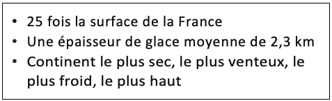
Antarctica (from anti-arktos, opposite the Big Dipper indicating the North, thus the Arctic), appears on maps as a quasi-circular continent of about 4,500 km in diameter (the distance from Paris to Baghdad), larger than the United States or Mexico combined, or 25 times the surface area of France (14 million km2). This frozen "end of the world" is totally isolated from the rest of the world. It is 1,000 km from South America, 2,500 km from Australia and 4,000 km from Africa.
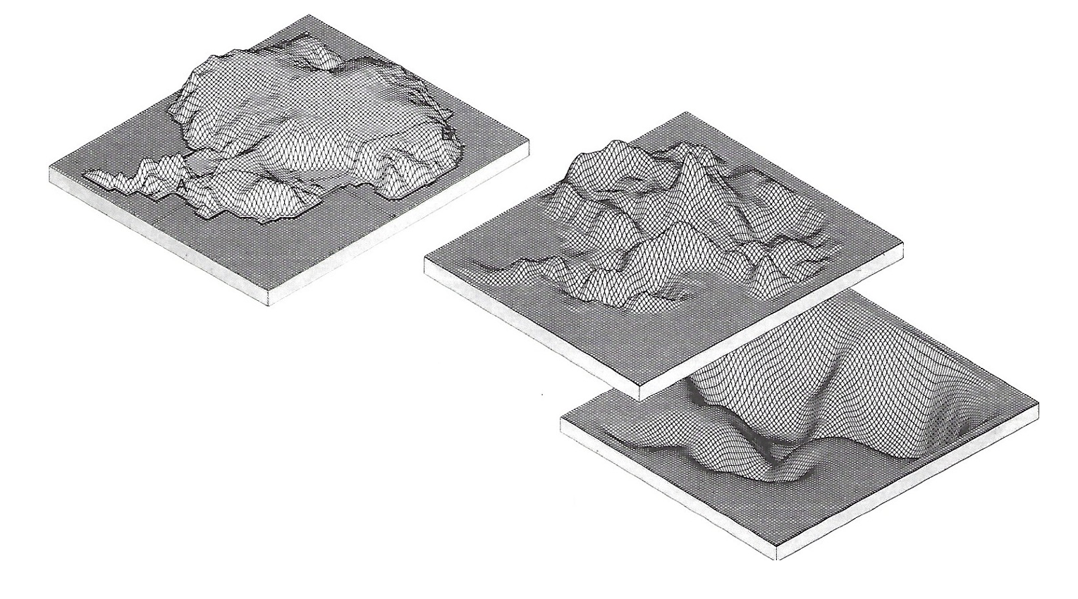
It is thanks to satellites equipped with radar that we were able to trace the topography of this continent for the first time and understand that under these 2.3 km of average ice thickness, there are mountains, canyons, and even lakes!
This structure corresponds to what is called a cap, which can be represented as a large ice cake, whose formation began 35 million years ago and which is fed by snowfall.
At the top of this cap is the plateau, then on the coasts rivers of ice or glaciers are formed until they reach the coastline and flow into the sea. As they advance over the water, they form ice shelves that can be fed by several glaciers and that will interact with the oceans. When they break up, they will form an iceberg. This is called calving.
70% of the world's fresh surface water is found here, and the thickness of the ice cap can reach 4 km (the point where the ice cap is thickest is in the east, not far from Terre Adélie and would be approximately the height of Mont Blanc!) The melting of all this ice would lead to an increase in sea level of 60 meters worldwide.
What you should know :
The overload caused by the mass of this ice cover is so great that the bedrock is sinking into the relatively viscous earth's mantle in many places. If the ice disappeared, the lightening would let the continent rise several hundred meters - with a delay due to the viscosity of the mantle - like a barge being unloaded. This phenomenon, called isostasy, governs the vertical movements of all the masses of the Earth's crust. In the Northern Hemisphere, Scandinavia is "rising" by as much as one meter per century, due to the disappearance of a large cap that covered it during the last ice age.
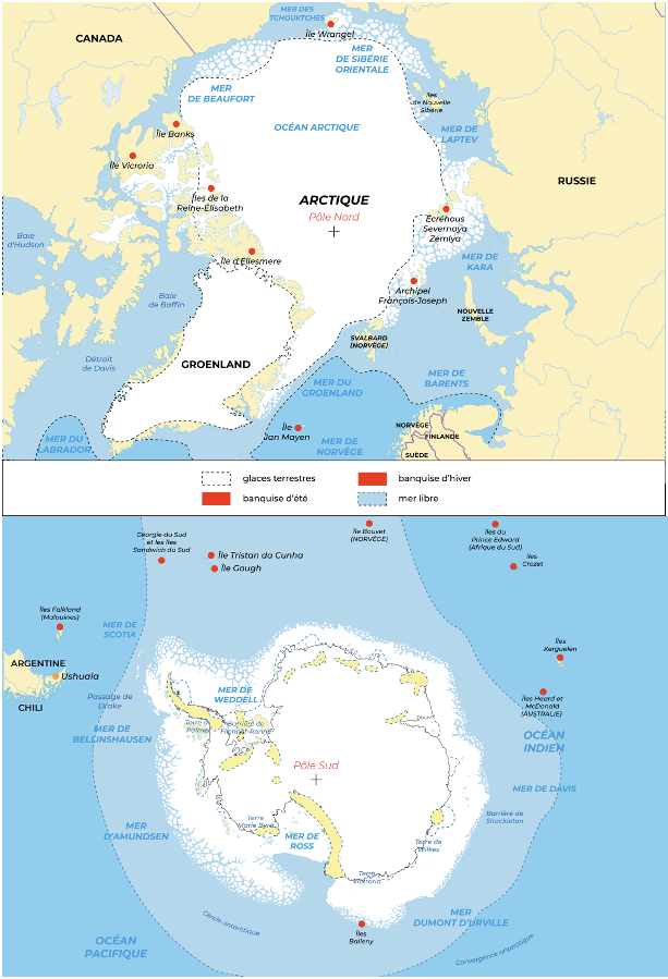
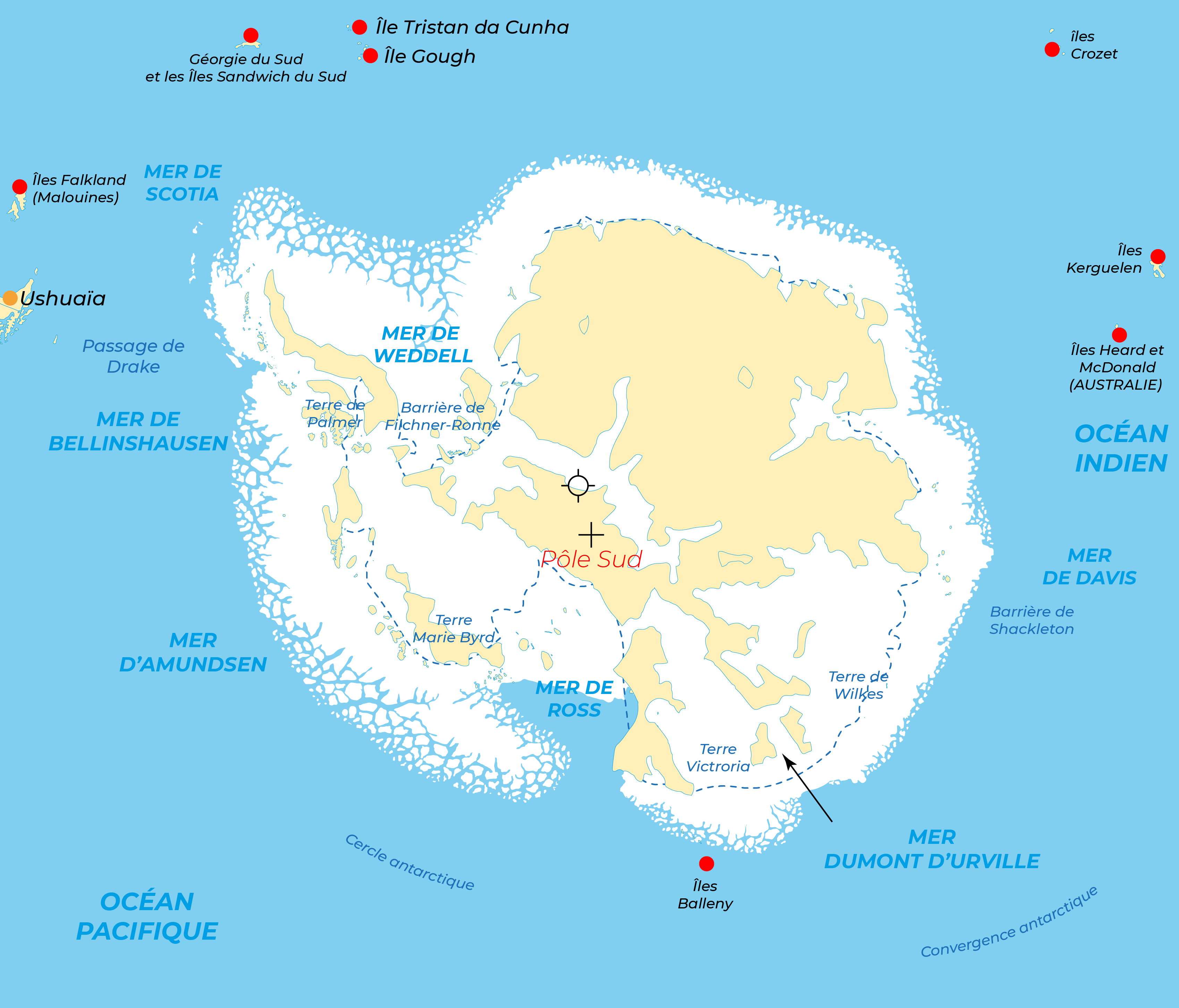
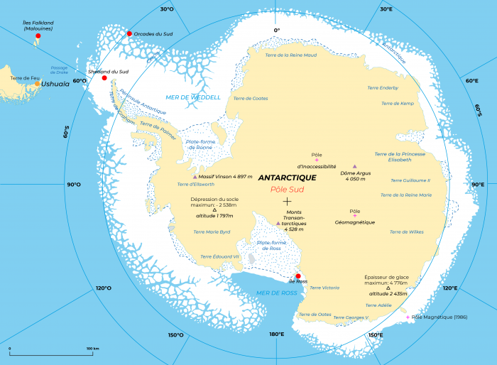
The Antarctic continent is made up of 3 main parts: the comma-shaped Antarctic Peninsula, which rises towards South America, East Antarctica to the south of Australia and Africa and finally West Antarctica separated by the Trans Antarctic Mountains. Under the cap, Antarctica is no longer a continent, but an archipelago of islands. If the maximum altitude of the ice cap reaches 4 050 m (Argus Dome), the real highlight of the
is Mount Vinson (4 897 m) in the Ellsworth Mountains.
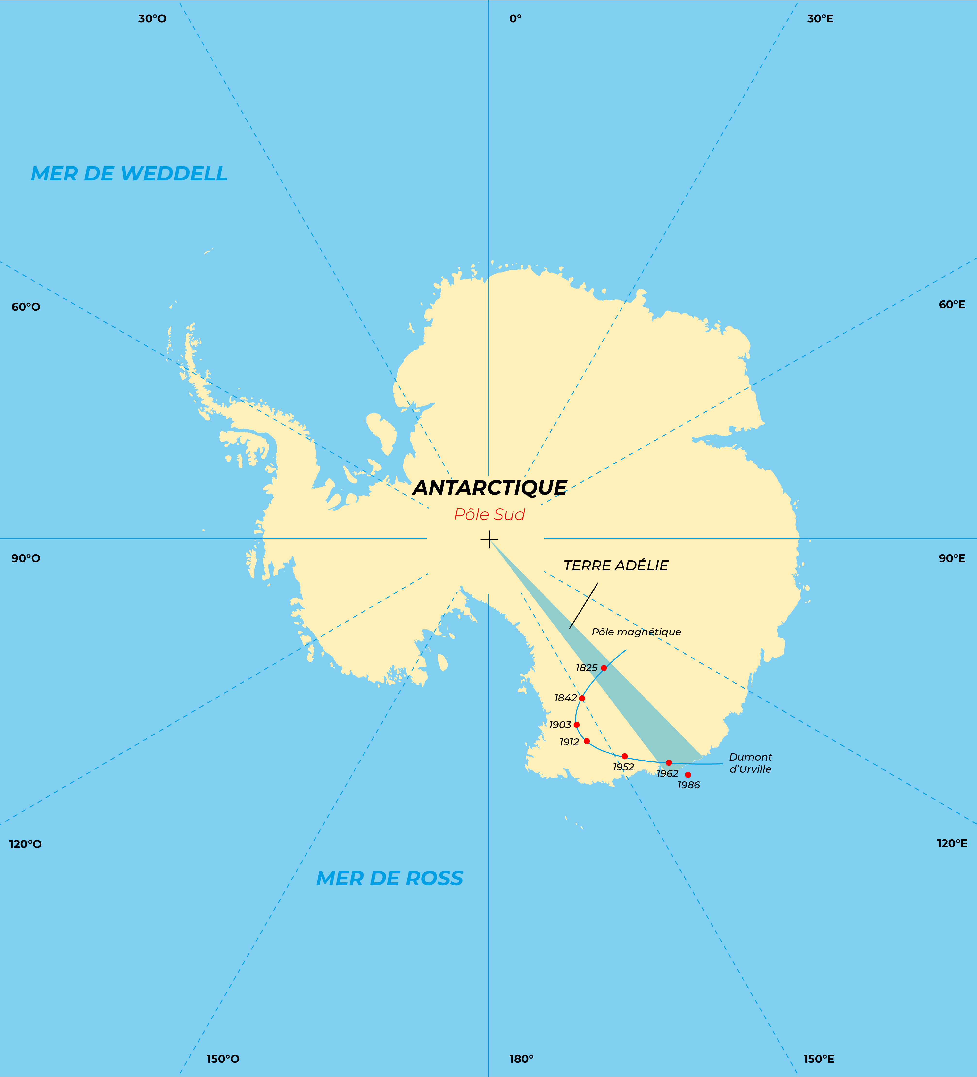
Antarctica is centered on the south geographic pole (Earth's axis of rotation). There is also a geomagnetic south pole; this fixed point corresponds to the extension of the direction of a theoretical "bar magnet" (magnetic dipole) that is placed at the center of the Earth with an inclination of 11° with respect to the axis of rotation, allowing to account for the main magnetic field. More important in practice is the south magnetic pole; this is the point you would reach if you were to follow the south with your compass. It is constantly moving about 12 km per year, but we do not know exactly why (magnetic disturbances in the upper atmosphere, convection currents in the iron core of the planet). The magnetic pole can be located at sea, or on land, and is regularly found near the Dumont d'Urville station in Terre Adélie.
Another particular point must be noted: it is the pole of inaccessibility calculated by cartographers and which is the farthest place from the coasts. The Russians have also determined and reached what they call "the pole of absolute cold".
The status of Antarctica is quite particular and is governed by the Antarctic Treaty. Signed on December 1, 1959 in Washington, D.C. by the 12 countries whose scientists had engaged in activities in Antarctica during the International Geophysical Year of 1957-1958, it came into force in 1961. This treaty commits its signatory countries to freeze their territorial and economic claims and dedicates the continent to peace and science.
Suggested activities :
The Antarctic continent
- Calculate the volume of fresh water present in the ice covering Antarctica. Compare this volume to the water consumption of a city like Paris (1 million m3 per day).
- What rise in global sea level would the melting of the Antarctic ice produce? Try to imagine Europe in these conditions...
- On a world map, compare the glacial extension of the last great Paleolithic glaciations with this Antarctic ice cover (in addition to the ice sheets covering the mountains such as the Vosges and the lower Alpine valleys, this ice cap went down to the border of Denmark and Germany).
For more details
Books :
- Glaces de l’Antarctique - C. Lorius.
- La Voix des pôles - L. Lescarmontier.
- Salut au grand Sud – I. Autissier & E. Orsenna.
- Vostok, le dernier secret de l’Antarctique - JR Petit.
Miscellaneous:
- Blogs des hivernants de l’institut polaire : institut-polaire.fr
Support the project with a donation
The Polar POD expedition is one of the stamp of the pioners, a human adventure coupled with a technological challenge, an oceanographic exploration never before carried out which will mark a milestone in the discovery of the oceans.
Thank you for your support !